Schreiber Maps circa 1750: Atlas Selectus
Lehigh Special Collections has recently digitized a series of maps collectively known as the Atlas Selectus.

(Globus Terrestris, Atlas Selectus)
The maps were jointly created by Johann Georg Schreiber (1676-1750) and his father, Johann Christof Schreiber, cartographers and engravers based in Leipzig, Germany. They prepared the Atlas Selectus, a detailed compilation of world maps with a special emphasis on Germany, though most regions of the world that were known at the time are depicted. The atlas was posthumously published circa 1750.
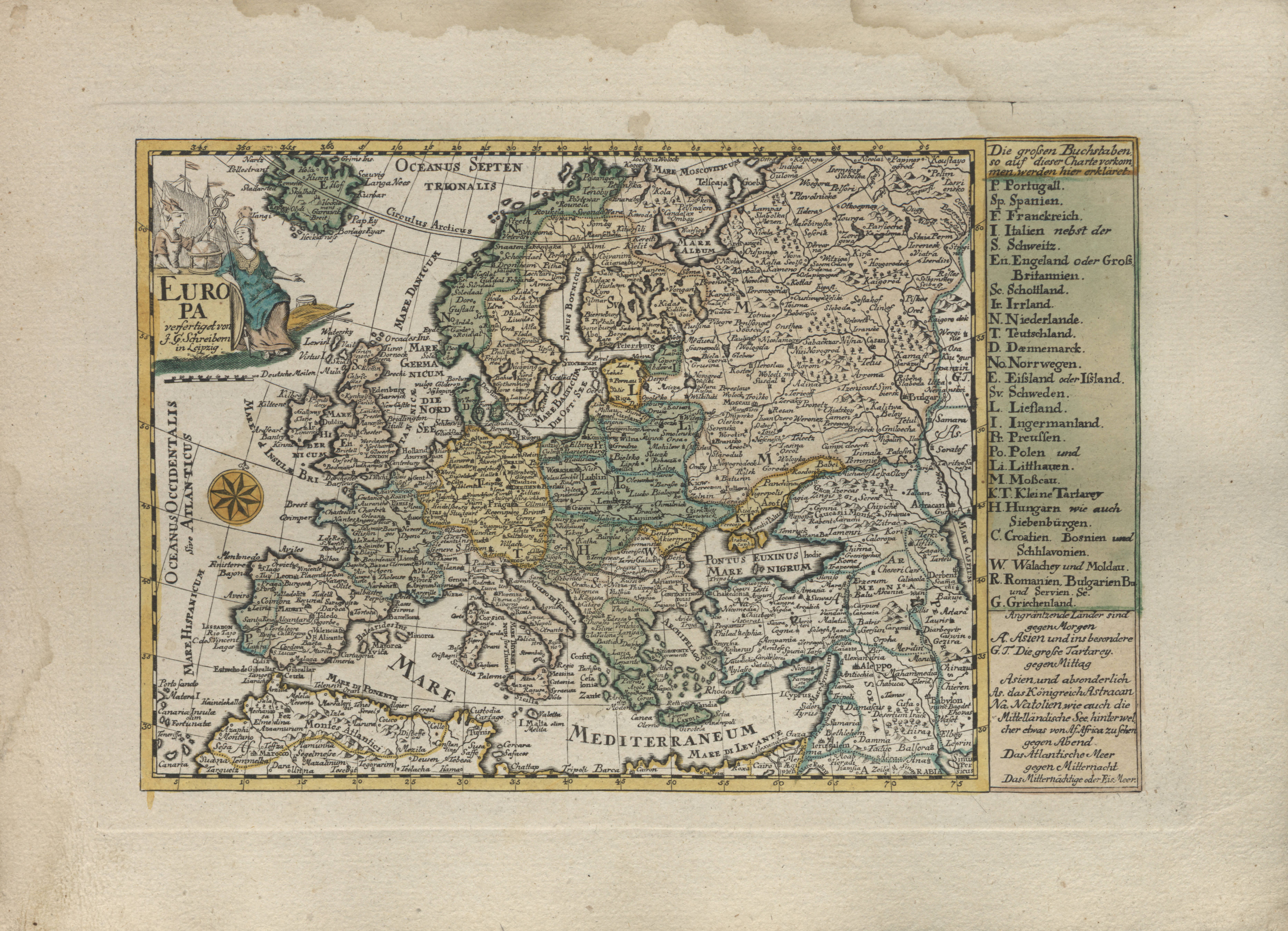
(Above: Europa [Europe])

(Above: Nord America [North America])
There are a total of more than thirty copper-engraved maps in the Atlas Selectus, including 26 of Europe, as well as maps of every known continent, three maps of Asia, maps of Russia and the Balkans, and a world map.
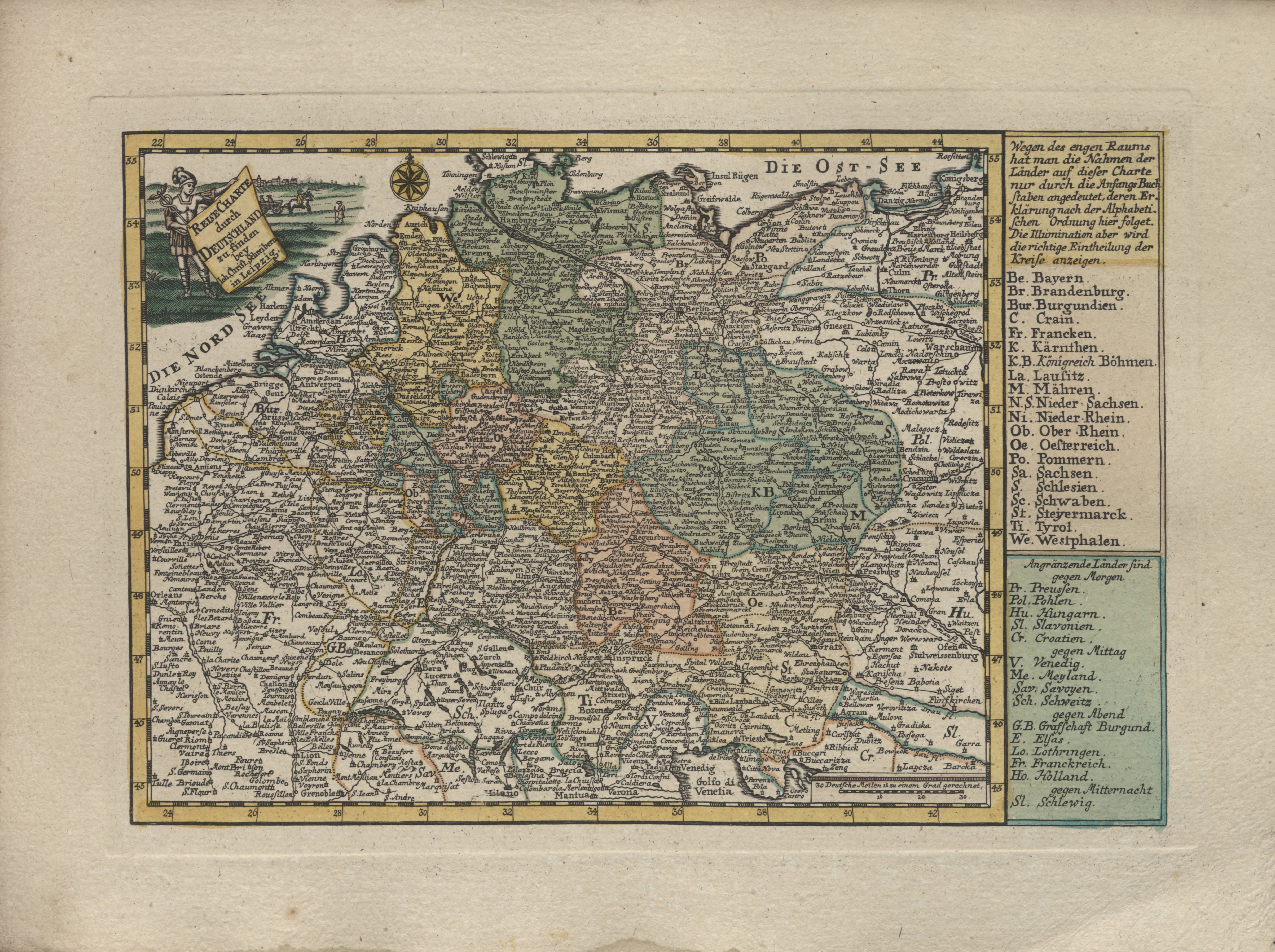
(Deutschland [Germany])
Johann Georg Schreiber was born in Spremberg, the sixth of seven children. When he was growing up, his family lived modestly but relatively well-to-do. His other works include a plan of the city of Bautzen–a copper engraving completed in 1700–an atlas of Saxony, the Atlas Geographicus, and numerous others. A number of his works were published posthumously.
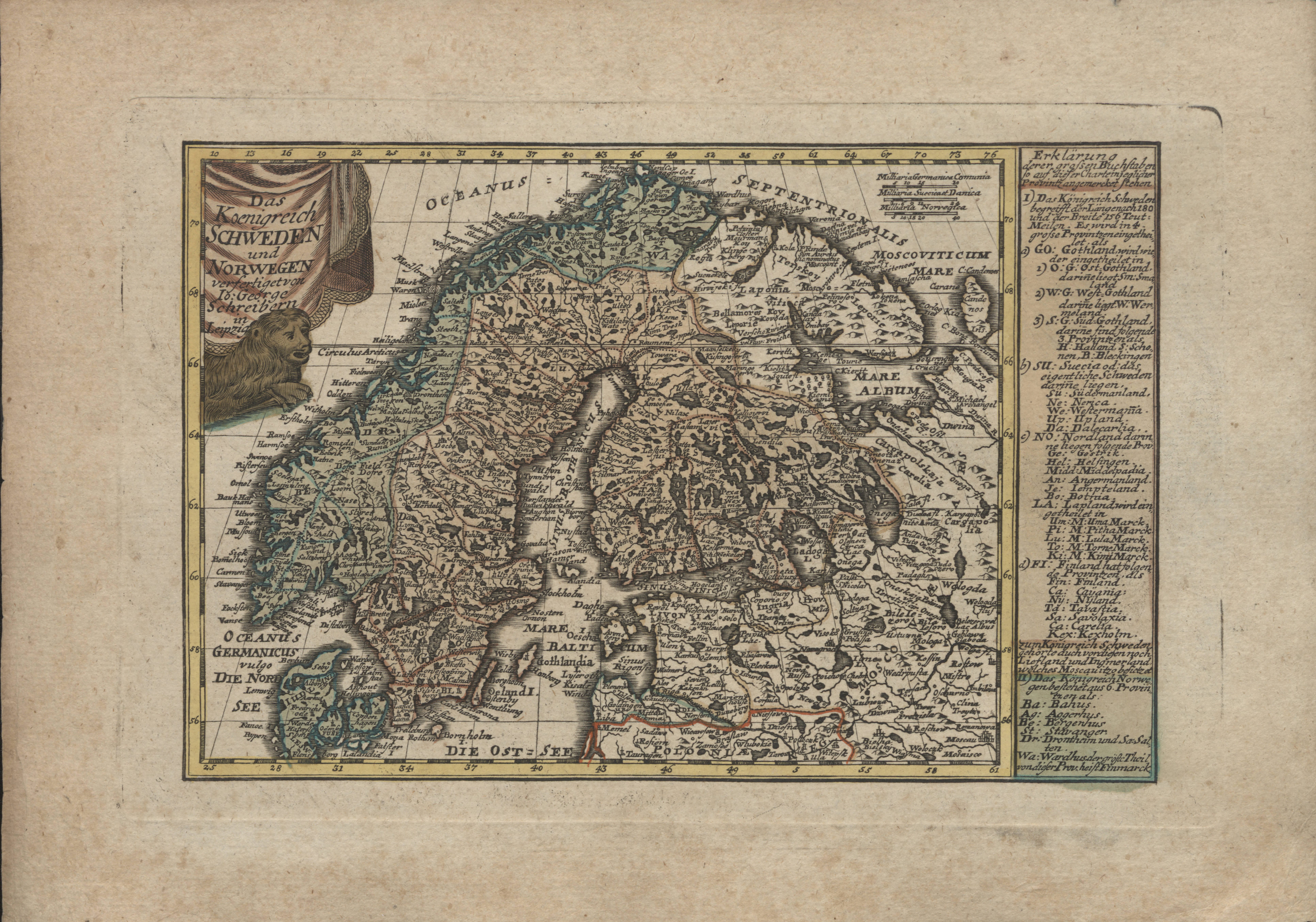
(Schweden und Norwegen [Sweden and Norway])
Lehigh’s set of Schreiber maps is now available to view and download. For more information about Lehigh’s holdings, see our finding aid.